PORTLAND, OREGAON, UNITED STATES, February 9, 2024 /EINPresswire.com/ -- According to a new report published by Allied Market Research, titled, "Geospatial Solutions Market Size, Share, Competitive Landscape and Trend Analysis Report by Solution Type (Hardware, Software, Services), by Technology (Geospatial Analytics, GNSS & Positioning, Scanning, Earth Observation), by Application (Surveying, Navigation & Mapping, Geovisualization, Asset Management, Planning & Analysis, Others), by End Use (Utilities, Defense and Intelligence, Transportation and Logistics, Infrastructural Development, Natural Resources, Agriculture, Others): Global Opportunity Analysis and Industry Forecast, 2021-2031."
𝐆𝐞𝐨𝐬𝐩𝐚𝐭𝐢𝐚𝐥 𝐒𝐨𝐥𝐮𝐭𝐢𝐨𝐧𝐬 𝐌𝐚𝐫𝐤𝐞𝐭 𝐒𝐭𝐚𝐭𝐢𝐬𝐭𝐢𝐜𝐬 𝟐𝟎𝟐𝟏-𝟐𝟎𝟑𝟏 :
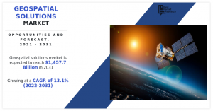
The global geospatial solutions market was valued at $432 billion in 2021, and is projected to reach $1,457.7 billion by 2031, growing at a CAGR of 13.1% from 2022 to 2031.
𝐑𝐞𝐪𝐮𝐞𝐬𝐭 𝐒𝐚𝐦𝐩𝐥𝐞 𝐏𝐚𝐠𝐞𝐬 : https://www.alliedmarketresearch.com/request-sample/9642
North America is expected to dominate the global geospatial solutions market in 2021. Rise in investments in the defense sector and technological advancements in the telecommunication industry acts as key driving forces for the geospatial analytics market in North America. In addition, implementation of LBS-enabled drones for border security and monitoring high-risk situation by federal agencies, government, and nongovernment organizations is expected to boost the market investment for these services. Advanced sensors onboard satellites provide reliable, cost-effective, and impartial information about variety of vegetation and hydrological parameters at various spatial resolutions.
Cloud-based geospatial solutions are gaining traction at the moment. Cloud-based geospatial solutions deliver on-demand geospatial data, images, and maps. It also enables companies to share data and perform operations such as viewing, monitoring and analyzing geospatial data. Moreover, few companies are also launching cloud-based geospatial solutions, which fuels growth of the geospatial solutions market. For instance, in April 2019, HERE launched Here XYZ for mapmaking and geospatial data management for developers and non-coders. It also launched a new cloud service for fast and flexible management of location data.
Growth of the global geospatial solutions market is attributed to increase in penetration of artificial intelligence based geographic information system (GIS), and increase in use of location-based services integrated with geographic information system. However, lack of awareness regarding benefits of geospatial solutions is the factor that hampers growth of the market. Furthermore, development of 4D GIS software is the factor expected to offer growth opportunities during the forecast period.
𝐏𝐫𝐨𝐜𝐮𝐫𝐞 𝐂𝐨𝐦𝐩𝐥𝐞𝐭𝐞 𝐑𝐞𝐬𝐞𝐚𝐫𝐜𝐡 𝐑𝐞𝐩𝐨𝐫𝐭 𝐍𝐨𝐰 : https://www.alliedmarketresearch.com/geospatial-solutions-market/purchase-options
𝐂𝐎𝐕𝐈𝐃-𝟏𝟗 𝐈𝐦𝐩𝐚𝐜𝐭 𝐀𝐧𝐚𝐥𝐲𝐬𝐢𝐬 :
The COVID-19 crisis has created uncertainty in the geospatial solutions market, massive slowing of supply chain, falling business confidence, and increasing panic among customers. Governments of different regions have already announced total lockdown and temporary shutdown of industries, thereby adversely affecting the overall production and sales. Countries around the globe have posed stringent restrictions ranging from days to months of lockdown periods. Owing to this pandemic, many businesses have been halted and are waiting for the market conditions to improve.
During the COVID-19 pandemic, geospatial techniques such as geographic information system (GIS) and mapping were increasingly used to detect pattern of the disease. Geospatial solutions were also utilized to track real time updates on confirmed and active cases, which aided governments and health workers across the globe to identify and tackle the source of infection.
In addition, geospatial technologies such as GIS have been used to support precautionary measures. Location measures gained through use of GIS have helped identify, map, and tag congested places and locations to detect individuals who have tested positive or have recently travelled. This data enabled authorities to provide information about places, which need to be avoided.
𝐊𝐄𝐘 𝐅𝐈𝐍𝐃𝐈𝐍𝐆𝐒 𝐎𝐅 𝐓𝐇𝐄 𝐒𝐓𝐔𝐃𝐘 :
By solution type, the services segment is anticipated to exhibit significant growth in the near future.
By technology, the scanning segment is anticipated to exhibit significant growth in the near future.
By application, the geovisualization segment is anticipated to exhibit significant growth in the near future.
By end-use, the infrastructural development segment is anticipated to exhibit significant growth in the near future.
By region, Asia-Pacific is anticipated to register the highest CAGR during the forecast period.
𝐈𝐧𝐪𝐮𝐢𝐫𝐞 𝐁𝐞𝐟𝐨𝐫𝐞 𝐁𝐮𝐲𝐢𝐧𝐠 : https://www.alliedmarketresearch.com/purchase-enquiry/9642
𝐋𝐞𝐚𝐝𝐢𝐧𝐠 𝐌𝐚𝐫𝐤𝐞𝐭 𝐏𝐥𝐚𝐲𝐞𝐫𝐬 :
Apple Inc.,
Bentley Systems, Inc.,
General Electric,
GIS Cloud Ltd.,
Google Inc.,
L3Harris Geospatial Solutions, Inc.,
Oracle Corporation,
Living Map,
Mappedin,
Microsoft Corporation,
Pix4D S.A.,
SAP SE,
Telenav Inc.,
TomTom International BV,
Uber Technologies, Inc.
David Correa
Allied Market Research
+1 800-792-5285
email us here
Visit us on social media:
Facebook
Twitter
LinkedIn


